Tranquility Base (Landing Site 2)
Tranquility Base is the Apollo 11 landing location in Mare Tranquillitatis (the Sea of Tranquility). In pre-flight planning it was Landing Site 2 (earlier designated II‑P‑6), specified in the Lunar Surface Operations Plan at 0°43′N, 23°42′E, to be approached at a Sun elevation angle of 10.5–13.5° for favorable lighting and shadow definition. The name “Tranquility Base” was adopted by the crew as the Lunar Module’s surface call sign at the moment of landing.
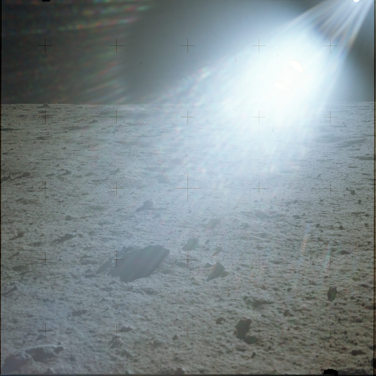
Samples returned from the site showed it to be a basaltic mare surface: the crystalline rocks are high-titanium mare basalts with a crystallization age of ~3.0 ± 0.7 × 10⁹ years, overlain by a fine regolith of fines and breccias shaped by repeated impacts. The surface was described from the cabin and during the EVA as a chalky-to-ashen gray, “fine and powdery” material.
The crew’s window-and-surface description in the Technical Crew Debriefing (§10.8–10.10) adds detail: a relatively smooth area pocked with craters from under a foot up to ~100 ft, their numbers inversely proportional to size, with a boulder field several hundred feet to the right that they never reached. The lighting dominated the scene’s appearance — the down-Sun direction was “extremely bright,” a light tan with a washout zone; toward cross-Sun the brightness fell and the color went gray, while the material seen up close was “charcoal gray… the color of a graded lead pencil.” Distance and size judgment were poor — with no familiar horizon cues, things looked closer and smaller than they were. The crew also found it hard to judge what was level, which complicated setting up the experiments.
The Mission Report gives the as-landed position as 0°41′15″N, 23°26′E (lunar map ORB‑II‑6(100)) — though the Preliminary Science Report’s soil-mechanics chapter gives 0.67°N, 23.49°E, about 1.7 km away in longitude; the two 1969 coordinates conflict and the library cannot adjudicate them (ledger A4). The LM rested tilted ~4.5° backward among the landmarks the crew had described: West crater, the sharp-rimmed blocky ray crater ~180 m across and ~30 m deep to the east-southeast (the “football-field” crater Armstrong flew past; the report’s “~400 m” stand-off is superseded by the measured ≈490 m to its rim / ≈575 m to its center on the LROC frame); a 33‑m crater ~50 m east; and a doublet crater ~10 m west. It estimates the local regolith at 3–6 m thick and places the site ~20 km southwest of Sabine D and ~25 km southeast of Surveyor V.
That same ground was later photographed from lunar orbit: LROC imaging shows the descent stage, the EASEP packages, and the astronauts’ trails west of West crater — independent confirmation of the landing geometry that no one could fix from orbit in 1969, and a direct measurement of it (the stand-off figures above).
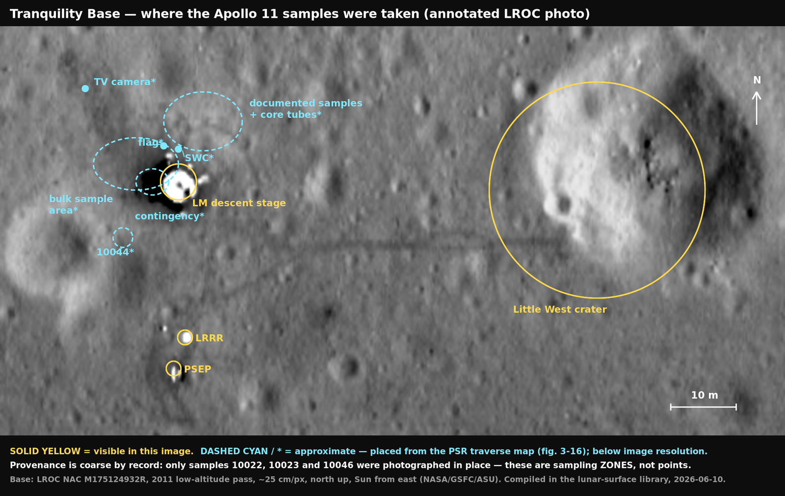
From the Tranquility Base photo-map.
Related
Section titled “Related”- Powered descent and landing
- Apollo 11 EVA (first moonwalk)
- High-titanium mare basalt
- Apollo 11 lunar sample types
- Lunar regolith and soil mechanics
- Lunar surface mobility in one-sixth gravity
- Apollo 11 mission
- LROC imaging of the Apollo 11 landing site
- Lunar field geology (Experiment S-059)
- Apollo 11 photographic index
Sources
Section titled “Sources”- Apollo 11 Lunar Surface Operations Plan
- Apollo 11 Preliminary Science Report
- Apollo 11 Technical Air-to-Ground Voice Transcription
- Apollo 11 Technical Crew Debriefing — Volume 1
- Apollo 11 Mission Report (MSC-00171)
- LROC NAC imagery of the Apollo 11 landing site