Lunar field geology (Experiment S-059)
S-059, the Lunar Field Geology experiment, was the systematic description of the landing site as a geologic locality — the crew’s in-situ observations, the documented sampling, and the photographic and television record that together place the returned samples in context. On Apollo 11 it was the lowest-priority objective and was cut short, yet it produced the first field geology done on another world.
What it established (Mission Report §11.1, §14.2; Preliminary Science Report ch. 3, Shoemaker et al.):
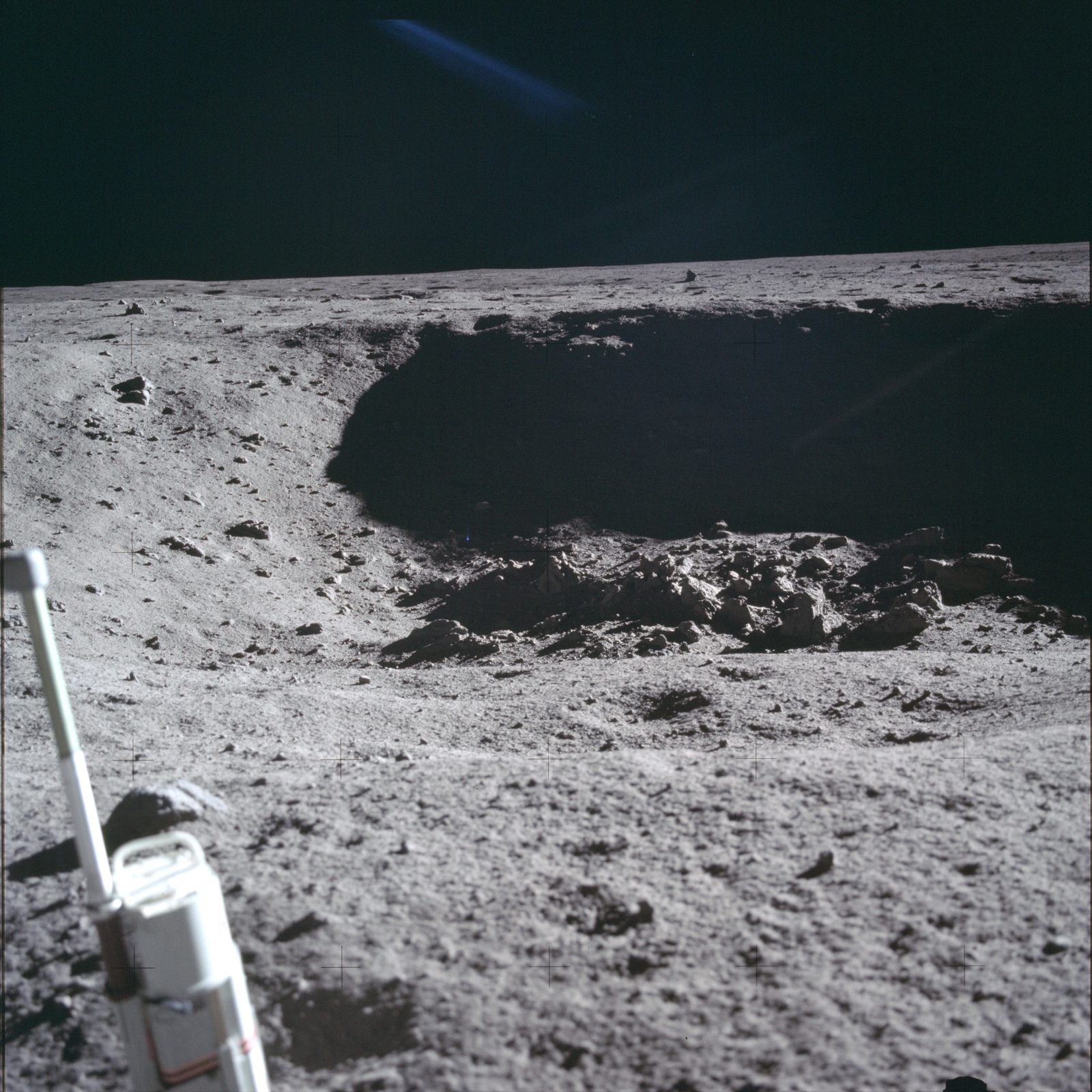
- The site is a mare basalt surface mantled by regolith ~3–6 m thick, pocked by craters from centimetres up to the sharp-rimmed West crater (~180 m; measured ≈490 m to its rim / ≈575 m to its center on the LROC frame, superseding the report’s “~400 m”), whose blocky ejecta the lunar module landed between.
- Local landmarks fix the geometry: a 33-m crater ~50 m east and a small doublet crater ~10 m west. Rocks are typically rounded on top, micrometeorite-pitted, with soil fillets banked against them and a thin dust patina — clues to how long each sat exposed.
- The returned rocks were impact-excavated from varying depths and reached the surface at different times (per their exposure ages), so the regolith is a long-gardened mixture rather than a simple stratigraphy.
The experiment’s data are the crew’s verbal descriptions, the still/sequence/close-up photography, the TV, and the samples themselves keyed to Tranquility Base. Because documented sampling — the part that ties a sample to a photographed spot — was truncated to about ten minutes, most Apollo 11 samples lack precise field provenance. In fact the record’s documentation quality runs in reverse order of scientific intent (provenance reconstruction): the emergency contingency grab is the mission’s best-located collection (taken in view of the sequence camera, its scoop spots later pinned on a pre-EVA window photograph), while the “documented” collection is, in the Sample Catalogue’s own words, “approximately 20 selected, but unphotographed, grab samples” gathered in the final ~3½ minutes — Armstrong’s verdict on the loop: “carefully selected, if not documented, samples.” Even where that final collection happened is contradicted in the primary record — the crew’s own PSR chapter says “15 to 20 ft north of the LM,” the Mission Report and Catalogue say “south… near the east rim of the large double crater” (ledger C).
What location data do exist are coarse: the contingency samples came from immediately in front of the LM, basalt 10044 from between the LM and the elongate double crater to the southwest, and the two drive tubes from within a few metres of the LM (only 10022, 10023, and 10046 were photographed in place). The local regolith is also salted with a small exotic component — rare highland (feldspathic) clasts (e.g. 22 in breccia 10063) and orange volcanic glass beads (10059) — foreign material delivered by distant impacts and rays.
Related
Section titled “Related”- Tranquility Base (Landing Site 2)
- Lunar regolith and soil mechanics
- Lunar sample collection and containers
- Apollo 11 surface photography
- Apollo 11 photographic index
- Surface exposure and space weathering (Apollo 11 samples)
Sources
Section titled “Sources”- Apollo 11 Mission Report (MSC-00171)
- Apollo 11 Preliminary Science Report
- Apollo 11 Lunar Sample Compendium
- Apollo 11 Lunar Sample Information Catalogue